


Landsat 9: Here Is What NASA's 'New Eye In The Sky’ Will Do In Orbit | EXPLAINED
Landsat 9, the latest in the series of NASA Landsat satellites, successfully blasted off into space on September 27, atop a United Launch Alliance Atlas V Rocket

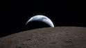
Landsat 9, a NASA satellite built to monitor Earth's land surface and resources, successfully lifted off from Vandenberg Space Force Base on September 27. Latest in the Landsat series, the satellite was powered by a United Launch Alliance Atlas V 401 Rocket. The satellite will extend a record of Earth observations spanning five decades.
Landsat 9 is almost a replica of its predecessor Landsat 8.
The Landsat mission holds the title for the “longest continuous space-based record of Earth's land in existence”, according to NASA.
Since 1972, the space agency has made sure that a Landsat satellite always stays in orbit.
Landsat 9 Mission Timeline
Landsat 9 is a joint effort between NASA and the US Geological Survey (USGS), and was successfully launched at 2:12 pm EDT, Monday (11:42 pm IST, Monday) from Vandenberg's Space Launch Complex 3E, blasting off towards the near-polar, Sun-synchronous orbit.
Exactly 83 minutes after launch, signals from the spacecraft were received by Norway's Svalbard satellite-monitoring ground station. The final orbital latitude of Landsat 9 is 438 miles (705 kilometres). The satellite is performing as expected, mentions the NASA website, and will work in tandem with its sister satellite, Landsat 8, which is in the same orbit, collecting images spanning the entire globe every eight days.
Landsat 9 mission was managed by NASA, and United Launch Alliance was the rocket provider.
History of Landsat satellites
The first Landsat was launched in 1972. These satellites capture images of the physical material covering the Earth and of the changes in land usage. Researchers use these images to monitor phenomena like agricultural productivity, water quality, forest extent and health, coral reef habitat health, and glacier dynamics.
An unprecedented visual record of Earth's landscapes, icescapes and coastal waters, in the form of 9 million scenes, have been provided by the eight Landsat satellites.
Instruments Aboard Landsat 9
Landsat 9 carries two science instruments— The Operational Land Imager 2 and the Thermal Infrared Sensor 2. These instruments measure 11 wavelengths of light reflected or radiated off Earth's surface, in the visible spectrum as well as other wavelengths in the electromagnetic spectrum, undetectable to the human eye.
The sensors on both the instruments have moderate spatial resolution (number of pixels utilised in construction of the image), depending on spectral band. A higher range in intensity can be detected by the sensor in Landsat 9, in comparison with those on Landsat 8. The radiometric resolution (information in a pixel expressed in bits) of Landsat 9 is 14-bit, while that of Landsat 8 is 12-bit.
To increase temporal coverage of observations, Landsat 9 has been placed in an orbit which is eight days out of phase with Landsat 8.
The two instruments will capture scenes across a swath of 115 miles, as the satellite orbits. An area of 98 feet or 30 metres is represented by each pixel in these images. Most crop fields in the United States can be identified by resource managers, at a resolution as high as that of the sensors.
More than 700 scenes of Earth will be added by Landsat 9 to the mission archive each day, once it becomes operational.
Operational Land Imager 2 (OLI-2): The function of OLI-2 is to capture observations of Earth in visible, near infrared and shortwave-infrared light. Ball Aerospace in Boulder, Colorado built and tested OLI-2.
Thermal Infrared Sensor 2 (TIRS-2): Thermal infrared radiation or heat (brightness temperature) of Earth's surfaces will be measured by TIRS-2. This is an upgraded version of the TIRS Instrument on Landsat 8, and was built and tested at NASA Goddard Space Flight Center in Greenbelt, Maryland. The instrument has improved reliability, and issues with stray light have been corrected.
The Landsat 9 Spacecraft
The Landsat 9 Spacecraft was built by Northrop Grumman. The corporation designed and fabricated the spacecraft and integrated it with the government-furnished instruments. They also conducted satellite-level testing. In-orbit checkout and mission operations support were be aided by Northrop Grumman after launch.
The data from the instruments are stored and processed by the USGS Earth Resources Observation and Science (EROS) Center in South Dakota, continuously adding information to five decades of data from all Landsat satellites. One can freely download the images and embedded data, and since 2008, there have been 100 million downloads. USGS EROS will also perform the functions mission operation, ground system management, and Landsat archive maintenance.
What Does Landsat 9 Plan To Do?
Landsat 9 is important for Informed Land Use Decisions, when issues related to land use and resource availability arise. The ability to measure changes on Earth's land surface, at a scale where human and natural causes of change can be separated, will be taken further with Landsat 9.
In this way, Landsat 9 will play an important role in the international strategy for monitoring the health and state of Earth, and more observations will be obtained more frequently, which is every eight days, using Landsats 8 and 9.
It will perform functions like water quality monitoring, and provide crop condition reports and weeky tropical deforestation alerts. Landsat has emerged as a cornerstone of the global constellation of imagers, because of its unprecedented performance in international and commercial remote sensing.
The Landsat archive, when carefully calibrated, serves as a 'global standard' for studies which use multiple sources of satellite imagery.
Landsat 9 will monitor key areas such as tropical deforestation and global forest dynamics, urban expansion, water Use, coral reef degradation, glacier and ice-shelf retreat, natural and man-made disasters, and climate change.
In tropical deforestation dynamics, Landsat 9 will add to the impartial and unbiased record of Earth's forests in the Landsat archive, for verification of the claims of environmental protection and carbon storage. This information will be very beneficial for world governments and resource organisations.
In terms of urban expansion, visualisation of the impact of humankind's convergence on urban centres will be possible due to the Landsat record. Also, environmental consequences can also be understood.
Landsat 9 will monitor water use, by serving as an invaluable tool for managing water in areas such as the Western US, where water scarcity is a major issue.
Landsat 9 will also continue Landsat's legacy of monitoring Earth's reefs. The archive has recorded changes to 98 per cent of Earth's glaciers, and Landsat 9 will continue monitoring the glaciers.
Landsat data is used to map disaster impacts to save lives, as part of the International Disaster Charter.
Most importantly, a direct view of the effect of five decades of climate change on Earth's surface and biology will be provided by Landsat data.
What Do NASA And Its Partners Say About Landsat 9?
NASA Administrator Bill Nelson said NASA uses a unique set of instruments of other nations to study the Earth and its climate systems, as mentioned on the space agency's website. He added that NASA has a 50-year data bank, due to the previous Landsat missions, and that Landsat 9 will further the invaluable global program.
In order to understand the planet, NASA is looking forward to working with USGS and the Department of the Interior to build the next Landsat.
John Grunsfeld, former NASA Associate Administrator for Science, said it is important to continue the critical observations made by Landsat satellites, and their value will only grow in future, considering the long term environmental changes seen on planet Earth.
Interior Secretary Deb Haaland said Landsat 9 is a major milestone in the nearly 50-year partnership between USGS and NASA, because of which valuable scientific information has been collected with utmost scientific integrity. He added that Landsat 9 will provide data and imagery to make science-based decisions on crucial issues such as water use, coral reef degradation, glacier and ice-shelf retreat, wildfire impacts, and tropical deforestation.
Karen St. Germain, director of the Earth Science Division at NASA Headquarters in Washington, said that the Landsat mission is like no other, because for nearly 50 years, Landsat satellites observed Earth, providing an irreplaceable record of how our planet's surface has changed over the decades. A wide range of data has been obtained, from farmers to resource managers and scientists, which can help scientists understand, predict and plan for the future in a changing climate, he said.
Thomas Zurbuchen, associate administrator for science at NASA, said Landsat 9 will serve as the “new eyes in the sky”. He added that a more comprehensive look at Earth, than ever before, will be obtained because the spacecraft will work in tandem with other Landsat satellites, and the Sentinel-2 Satellites operated by the European Space Agency. He explained that scientists will have observations of any place on the planet, every two days, because of the satellites working together. This will help in tracking crop growth, and facilitate decision making in monitoring the overall health of our home planet and its natural resources.
NASA Landsat 9 project scientist Jeff Masek said the best part will be when Landsat 9 will start delivering the data, which everyone awaits.

Top Headlines