


ESA's Mars Express Captures Red Planet's 'Grand Canyon': See PICS
The ESA's Mars Express has captured two ruptures in the Martian crust which appear like the United States' 'Grand Canyon'. The Valles Marineris is the largest canyon system in the Solar System.

The European Space Agency's (ESA's) Mars Express has captured two ruptures in the Martian crust which appear like the United States' 'Grand Canyon'. These ruptures in the Martian crust form part of the mighty Valles Marineris canyon system on the Red Planet.
The Grand Canyon, a natural formation in Arizona which is distinguished by layered bands of red rock, is miniscule in comparison with the Valles Marineris on Mars.
The Valles Marineris
According to the official website of the ESA, Valles Marineris is almost 10 times longer, 20 times wider, and five times deeper than the Grand Canyon. The Valles Marineris is 4000 kilometres long, 200 kilometres wide, and up to seven kilometres deep.
The Valles Marineris is the largest canyon system in the Solar System. Canyon refers to a deep valley with very steep sides. If the Valles Marineris was situated on Earth, it would have spanned the distance from the northern tip of Norway to the southern tip of Sicily.
A big difference between the Valles Marineris and the Grand Canyon in the US is that the latter was formed as the Colorado River eroded away. Meanwhile, the former is believed to have formed because of extension or stretching of the crust. The rise of the nearby Tharsis plateau and its volcanoes could have caused the crust to extend. Due to erosion, the 'crack' in the crust widened.
The Chasmata On The Red Planet
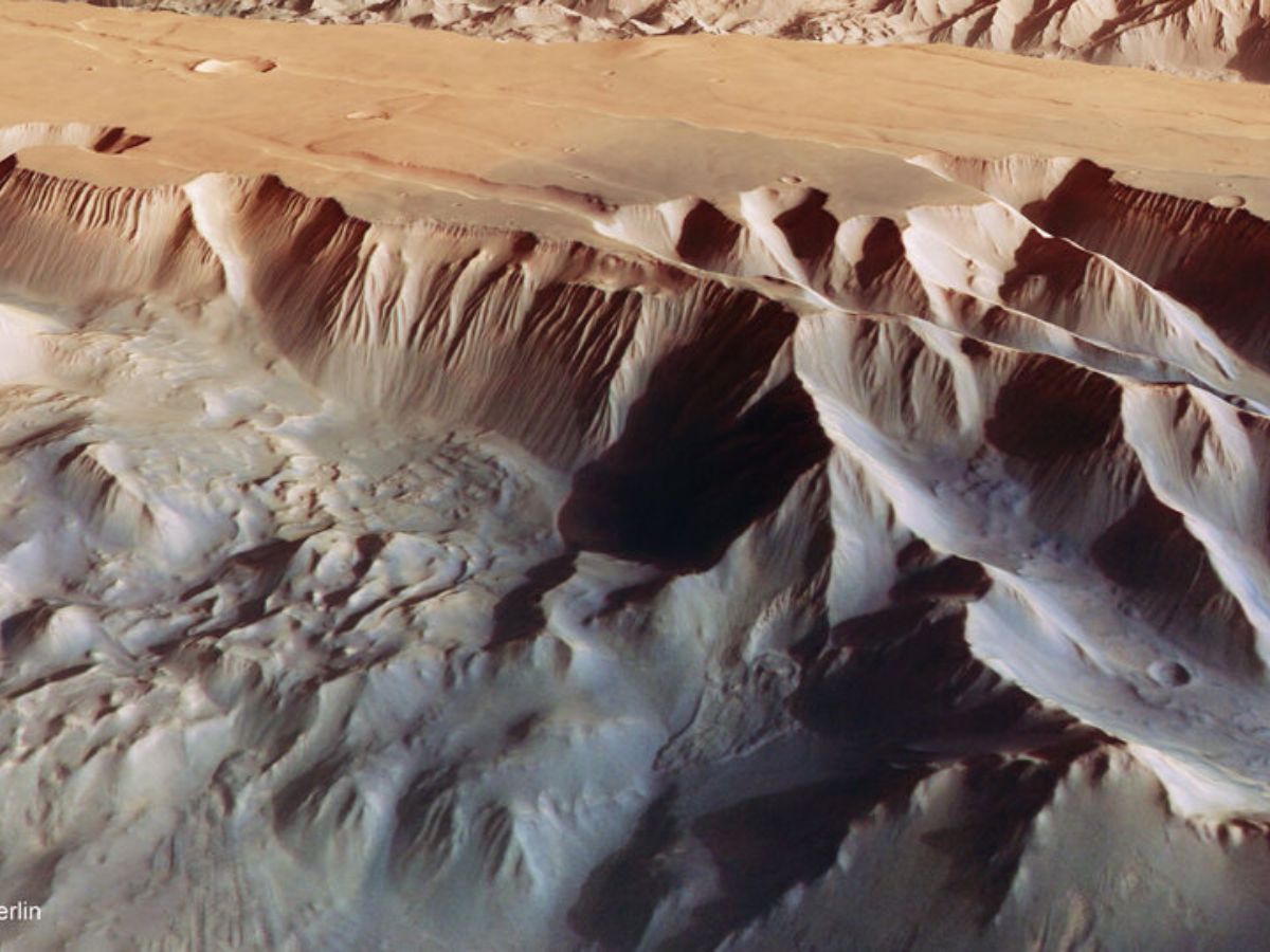
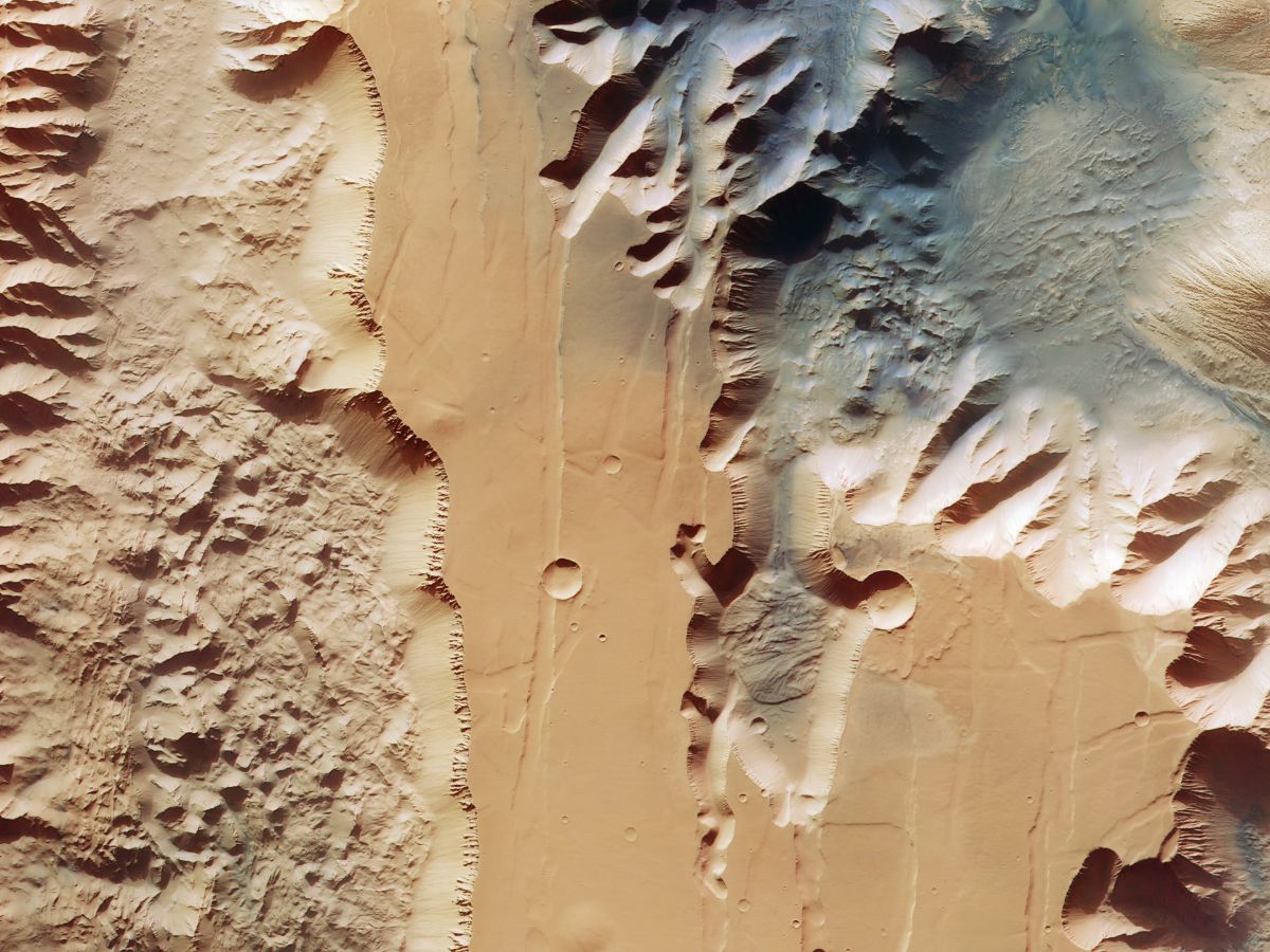
In the above image shared by the ESA, one can see two trenches, or chasma, that form part of western Valles Marineris. On the left side of the image, the 840-kilometre-long Ius Chasma can be seen, and on the right side, the 805-kilometre-long Tithonium Chasma is visible. The chasmata (plural for chasma) are up to seven kilometres deep. Chasma is a long, narrow, and steep-sided depression on a celestial object.
A patch of dark sand can be seen at the top of Tithonium Chasma in the image. The nearby Tharsis volcanic region may be the source of the sand.
Two light-toned mounds are located near the dark sand dunes. The mounds rise more than 3000 metres in height, and are like mountains. Mars' strong winds have eroded the surfaces of the mounds. This indicates the mounds are made of a weaker material than the surrounding rocks.
Parallel Lines And Debris On Mars
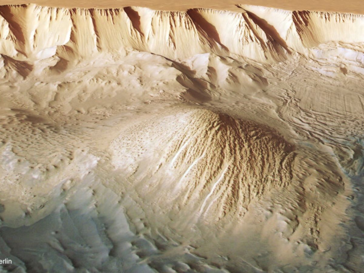
In the above image, one can see a series of smaller bumps between the two mounds. ESA's Mars Express has found water-bearing sulphate minerals in this region, suggesting that the bumps may have formed when liquid that once filled the chasma evaporated.
In the upper right part of the image, one can spot parallel lines and debris. These indicate a recent landslide.
Landslide On Mars
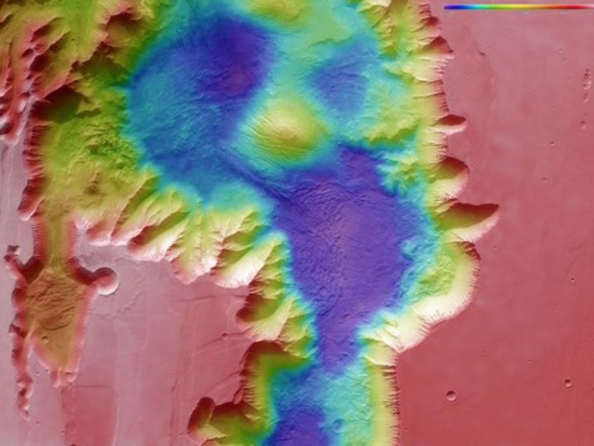
The large purple area in the topography image above indicates the landslide. A collapse of the canyon wall on the right may have caused the landslide.
Floors Of The Ius And Tithonium Chasmata
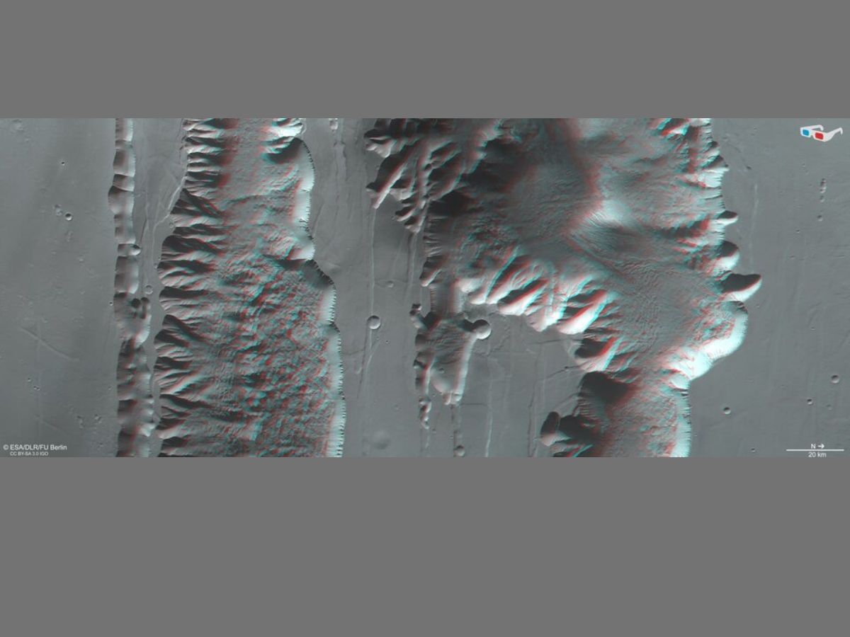
In the above image, the floors of the Ius and Tithonium Chasmata can be seen. The erosion and uplift of the Tharsis volcanic region caused the cracked crust to widen. This resulted in the formation of triangles of rock which appear like a row of shark teeth. The rock formations collapsed and eroded with time.
ESA's Mars Express is an orbiter that has been exploring Mars since 2003. It has imaged the Red Planet's surface, mapped its minerals, identified the composition of its atmosphere, and probed beneath its crust.

Top Headlines