


Over 3,500-Km Roads Near China Border — What Changed After Doklam
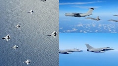
India at 2047: India needed a feeder road network to rapidly move troops and equipment up the mountains right up to the LAC in a quicker time frame. The 73 India-China Border Roads do exactly this.

War is too serious a matter to be left to generals, then French prime minister Georges Benjamin Clemenceau had said during the first World War. However, history has shown how even the best of strategies would fail if the generals were not consulted and the plans drawn without them. This is exactly what we saw during the debacle of 1962 India-China war.
Lt Gen SPP Thorat, then Army Commander of the Eastern Command, had drawn a plan now known as the Thorat Plan to defend the North East Frontier of Arunachal, or NEFA, in 1959 itself.
On October 8, 1959, the Thorat plan was sent to the Army Headquarters where the Chief, General KS Thimayya, approved it and personally showed the requirements to then defence minister VK Krishna Menon.
Unfortunately, Menon dismissed the plan, calling it alarmist and unnecessary, and boasted that he was confident of stopping the Chinese on his own with diplomacy. The Thorat Plan was not even shown to Jawaharlal Nehru, the then Prime Minister of India.
Indian leaders had taken those words of Georges Clemenceau as a gospel.
They had blundered.
The 1962 Debacle
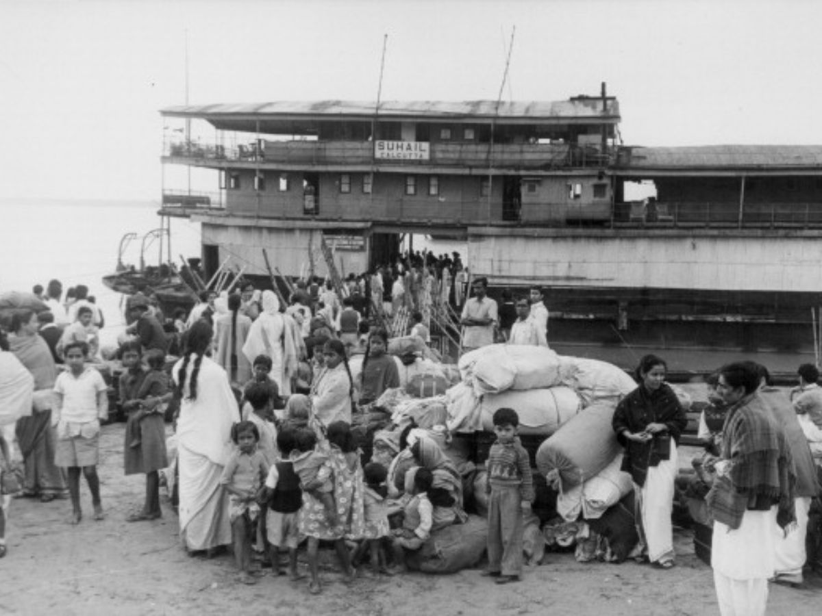
The People’s Liberation Army from China was a few kilometres away from Tezpur in the foothills when the ceasefire was announced on November 20, 1962, by the Chinese. Information reached late, and Assam’s Tezpur was a ghost town by November 22. People had to flee the town as the PLA advanced.
Indian defences had collapsed and the Army routed. We suffered a massive defeat. The scars of this debacle are still visible on the Indian psyche, somewhere.
The Chinese withdrew, beyond the watershed in NEFA, but stayed put in eastern Ladakh.
One of the compelling reasons for the Chinese withdrawal, leaving NEFA back in Indian hands, was the lack of road infrastructure. Roads were needed to build up fire power and logistics to hold the ground. Poor Chinese economy and primitive army made it impossible for them to retain the tactical gains. The PLA was overstretched on ground. Presumably, the Indian Army had collapsed too fast and beyond their expectations. They had probably not planned for such an outcome.
After the war was over, India decided to implement the same Thorat plan to defend NEFA, once discarded by Menon.
Why Ladakh Was Different
In Ladakh, the geography was different, so were the realities. It being an extension of the Tibetan plateau, area ahead in Ladakh offered easy cross-country mobility to the Chinese. The Indian side being rugged and mountainous offered terrain friction, which was advantageous to the Indian defenders. The Chinese road through Aksai Chin, connecting Xinxiang province with Tibet running parallel to the perceived boundary, altered the strategic calculations. Faster troops build-up and supported logistics placed the Chinese at a huge advantage. For us, we had the advantage of high mountains, so we templated our defences on lines similar to the Thorat plan.
In these years, whenever, India tried to develop its roads and infrastructure, there was huge Chinese pressure, forcing us to go back.
Throughout the 1960s, and right up to the 1990s, India was a weak economy. Struggling with food shortages to military challenges from Pakistan in 1965 and 1971, India strived hard to strike a balance to maintain its strong defences against the adversaries viz-a-viz overall economic development.
Owing to the lack of resources, it was decided to keep the infrastructure of NEFA underdeveloped as part of a defence strategy. The idea was to deter China on the Himalayan borders by maintaining strong tactical posture on the Line of Actual Control.
However, on the Chinese side, things began to change rapidly after the eighties. The Chinese economy under Deng Xiaoping took giant leaps. This created a disparity with India, which remains unbridgeable even after three decades, despite the opening of Indian economy by then PM Narasimha Rao and his finance minister Manmohan Singh in the early nineties.
Economic boom followed massive improvement in the Chinese infrastructure in Tibet. They built the 1,956-km-long Qinghai-Tibet railway (QTR), which connected Lhasa to Bejing, Chengdu, Chongqing, Guangzhou, Shanghai, Xining and Lanzhou. In strategic terms, all the major Chinese military regions were connected to Lhasa by this railway network. For forward troop movement, a railway link was recently inaugurated in 2021 that connects Lhasa to Nyingchi, just 50 km short of the LAC.
Extensive road network, airfields and forward storage facilities enable the PLA to concentrate troops and equipment in shortest possible time frame. Tibet has an impressive road network of a total length of 1,18,800 km.
The Indian Army has been flagging these concerns ever since the late nineties, but with little heed. Things changed in 2017, after the Doklam standoff.
What Happened In Doklam And The Lessons Thereof
India had started to witness PLA’s increased transgressions across the LAC since 2010. PLA soldiers had intruded into the Indian territory at various places across the 4,000-km LAC. There were over 500 incursions in a short span of three years between 2010 and 2013.
Since the end of 1962 war, India faced its biggest challenge from China in April 2013. PLA had intruded 10 km inside our territory of Eastern Ladakh in Depsang plains. The Chinese were maintained and supplied by helicopters, thanks to the improved infrastructure across. This alerted our planners, but the worse was yet to come.
In 2017, for 73 days, the Indian and Chinese forces faced off in a remote stretch of the Himalayan trijunction between India, Bhutan and China (Tibet). The problem started in June that year when Chinese army engineers attempted to build a road through the Doklam plateau, claimed by both China and Bhutan.
This region being critical for security of the strategic Jalpaiguri corridor, Indian soldiers intervened and stopped the Chinese crew in their tracks, resulting in a serious standoff between the two Asian giants.
After weeks of negotiations, Delhi and Beijing agreed to withdraw their troops to their original positions. China appeared browbeaten as it had to abandon the plans. However, they continued to quietly deploy troops and build new infrastructure in the area, slowly but steadily gaining advantage in this contested region.
The Indian Army has been flagging these concerns ever since the late nineties, but with little heed. Things changed in 2017, after the Doklam standoff.
Just three years later, the Indian and Chinese forces were once again in an eyeball-to-eyeball confrontation.
A violent skirmish between Indian and Chinese troops, first time in nearly 45 years, was reported in the Galwan valley on June 15, 2020, resulting in loss of lives on both sides. Massive mobilisation and concentration of troops brought both the countries to the brink of a war in the middle of the Covid-19 pandemic.
The northern Himalayan frontiers have remained on a knife's edge since those clashes, with both sides busy upgrading their infrastructure to sustain large concentrations of men and equipment. Simultaneously, both governments have engaged diplomatically, attempting a possible breakthrough while challenging each other’s claims, but have failed to finally disengage.
Border Infra Boom On Indian Side
After the Doklam crisis, India has in the last five years constructed over 3,500 km of roads. Correspondingly, China has built military infrastructure in Tibet, which includes 60,000 km of rail and road network. It must be noted that the Indian side is rugged and mountainous while the Chinese have an advantage of a flat and a gravelled Tibetan plateau.
The Chinese are planning to construct an expressway G-695, running parallel to the LAC connecting the Tibet Autonomous Region with Xinxiang. This will give the PLA yet another route to move troops and heavy equipment faster to border areas with India. The Chinese are constructing a second bridge across Pangong Tso for better connectivity between the north and south banks of this brackish lake.
The Indian Army has been flagging these concerns ever since the late nineties, but with little heed. Things changed in 2017, after the Doklam standoff.
To put things in a better perspective, India already has in place an extensive rail and road network running parallel to the Himalayas from Udhampur in the north-west in Jammu to Tinsukia in Assam in the far east, covering over 4,000 km. India needed a feeder road network to rapidly move troops and equipment up the mountains right up to the LAC in a quicker time frame. These 73 ICBRs do exactly this.
The writer is a defence expert, columnist and author. He is an associate editor with Indian Defence Review and consultant with ABP News.
[Disclaimer: The opinions, beliefs, and views expressed by the various authors and forum participants on this website are personal]

Top Headlines