Explorer

ISS Took Over 8 Lakh Earth Photos In 2024 — See 10 Best Images Capturing The Changing Planet

Best of 2024: The ISS has captured over 825,000 Earth images in 2024, contributing to studies of urban light patterns, lightning activity, and natural disasters. NASA has shared a few of them.

Earth In 2024: The International Space Station (ISS) has captured more than 825,000 images of Earth so far in 2024, documenting our planet’s changing landscapes. NASA has shared that over 5.3 million photos have been taken from the space station since it began operations, contributing significantly to studies of urban light patterns, lightning activity, and natural disasters. In 2024 alone, these images were instrumental in analysing 14 major natural disaster events, from hurricanes and floods to volcanic eruptions.

Expedition 71, one of the most prolific missions in the ISS's history, contributed over 630,000 images, marking the highest number of photographs taken during a single mission. 

According to NASA, the Crew Earth Observations (CEO) program is at the heart of this effort. Equipped with digital handheld cameras, astronauts photograph Earth from their vantage point 200 miles above the surface. The program focuses on documenting both human-induced changes — such as urban expansion and reservoir construction — and natural phenomena, including hurricanes and wildfires.

A key aspect of CEO’s mission is to provide real-time support for disaster response. The program works closely with the International Disaster Charter (IDC) through the US Geological Survey to deliver timely imagery that aids in disaster mitigation and recovery efforts. These photographs are more than snapshots; they are critical data for scientists, policymakers, and emergency response teams.

The tradition of photographing Earth from space dates back to the early Mercury missions of the 1960s. The ISS crew builds on this legacy, contributing to an unbroken "time series" of Earth imagery that helps track the planet's evolution. Almost half of all Earth photographs from NASA's human spaceflight missions have been taken aboard the ISS.

10 Best Earth Images Captured From Space In 2024

1. Idaho Wildfires

This image captures central Idaho’s forested mountains with smoke plumes from lightning-induced wildfires like Little Queens and Gold Pan, which burned over 53,000 acres. Westerly winds carried the smoke eastward.

2. Cancún’s Contrasts

Cancún’s urban layout contrasts with its marinas and coral reefs. The image highlights vibrant blue waters, white sand beaches, and reduced wave energy along protected shorelines.

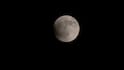
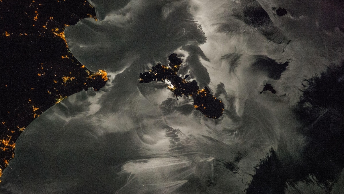
3. Moonlit Mediterranean

A nighttime view of Italy’s Elba island and surrounding towns showcases moon glint revealing sea surface patterns. City lights and dark sea areas blend in this stunning nocturnal image.

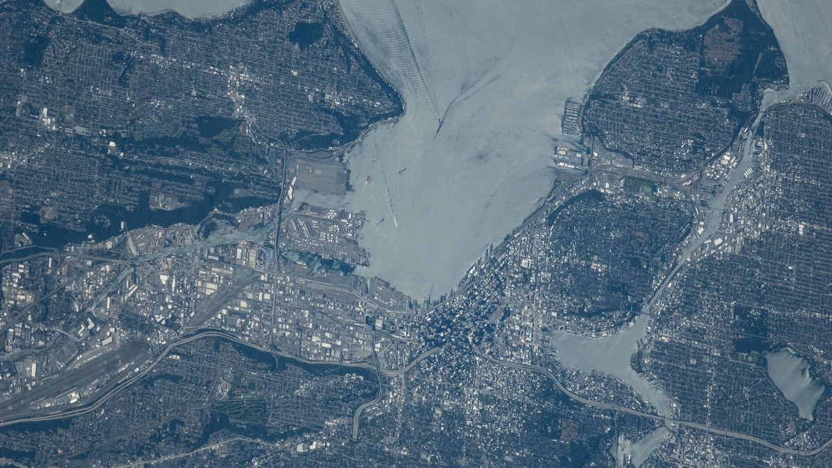
4. Puget Sound Reflections

This detailed shot of Puget Sound reflects the sun, highlighting boat wake patterns and Seattle’s urban landscape. Tree-covered suburbs contrast with downtown shadows cast by high-rise buildings.

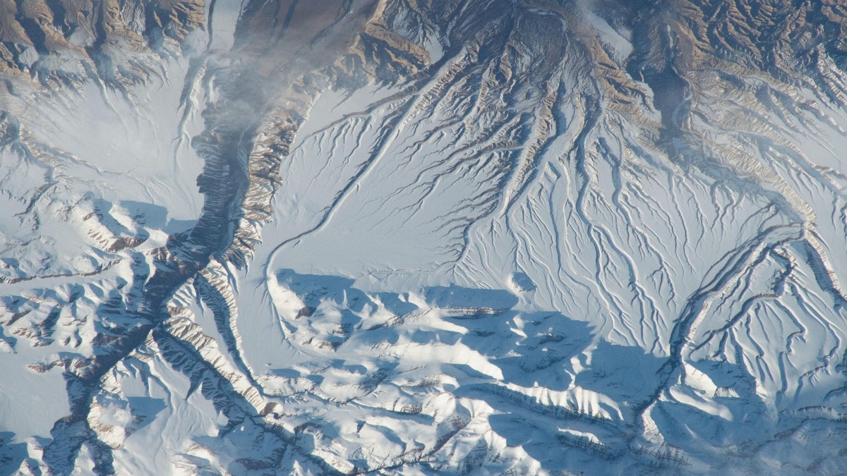
5. The Himalayas From Space
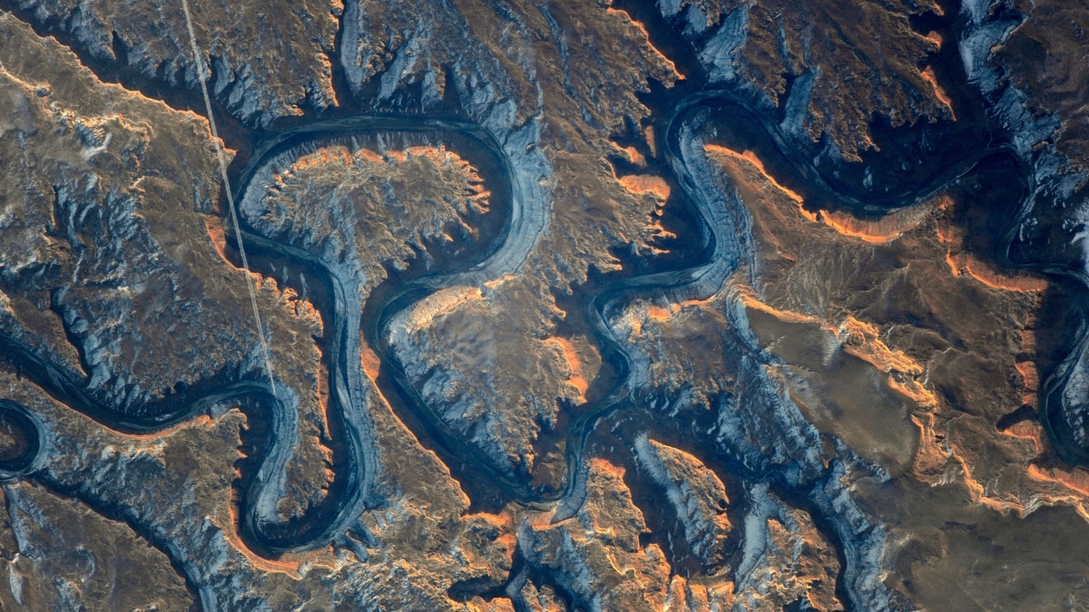
The Himalayas’ snowy peaks cast evening shadows in this oblique view. River erosion forms alluvial fans, with deep canyons slicing through the landscape, showcasing dramatic mountain topography.

6. Bowknot Bend

Bowknot Bend in Utah’s Green River canyon features striking meanders and steep cliffs. A jet contrail bisects the scene, revealing the interplay of natural and human activity.

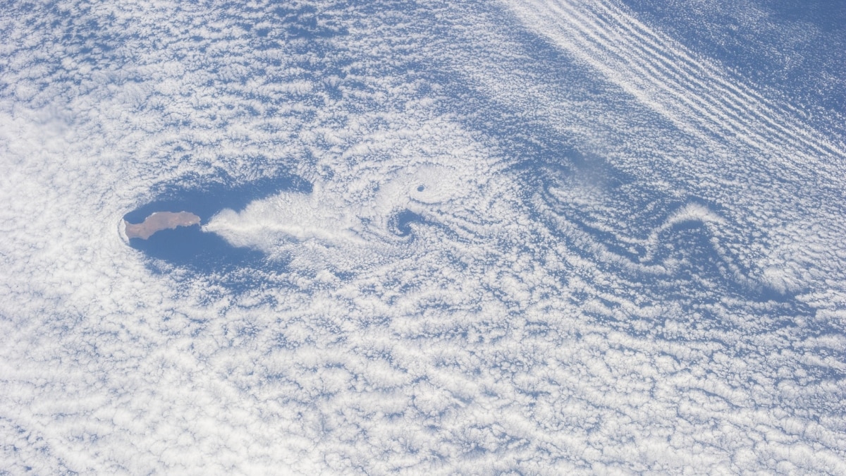
7. Guadalupe Island’s Cloud Swirls
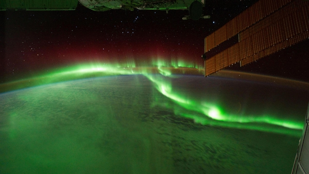
Guadalupe Island off Baja California creates Von Karman vortex streets, visible as cloud swirls. Winds interacting with the volcanic island form these striking atmospheric patterns.

8. Aurora Australis

Aurora australis lights up the Indian Ocean as seen from the ISS, with solar panels in the frame. This celestial display highlights Earth’s magnetic connection to the Sun.

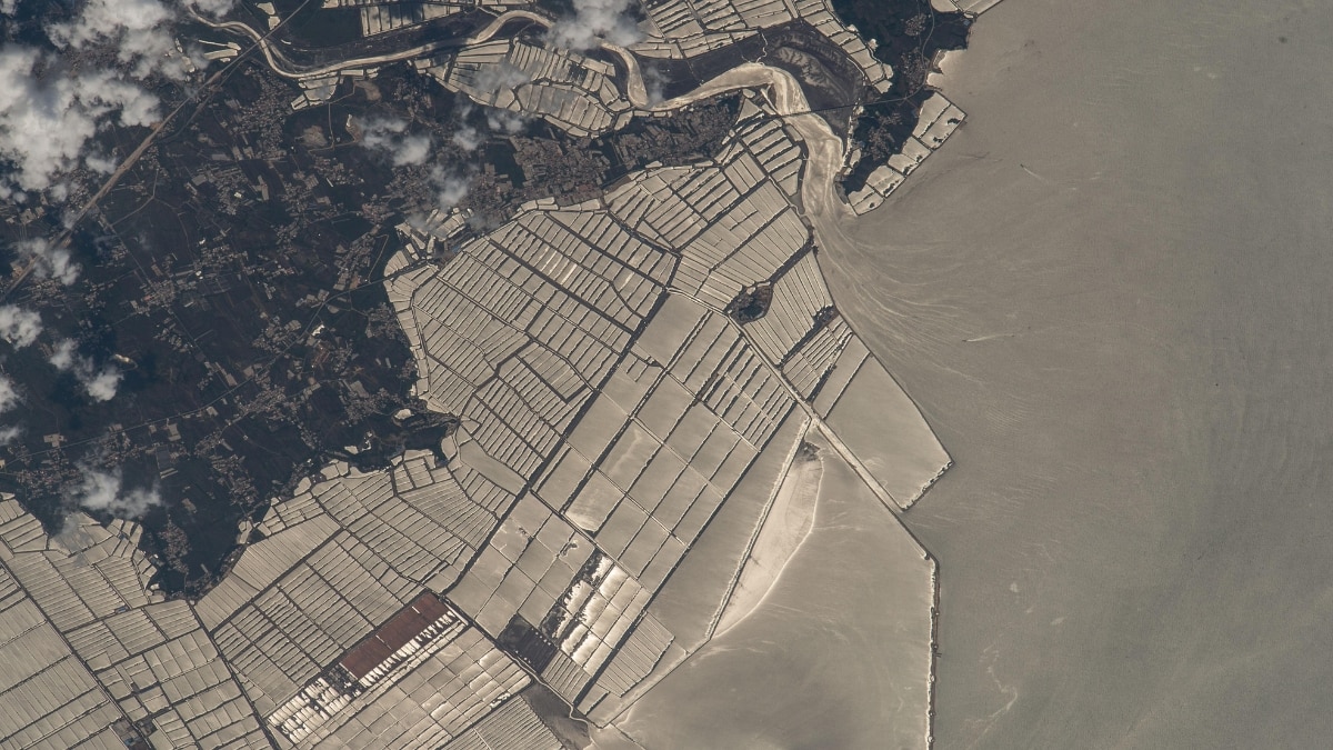
9. China’s Coastal Fish Farms

This high-contrast photo shows fish farms along Liaoning Province’s coast in China. Extending nearly 6 km into the Yellow Sea, these farms are the largest in the region, supporting significant aquaculture production.

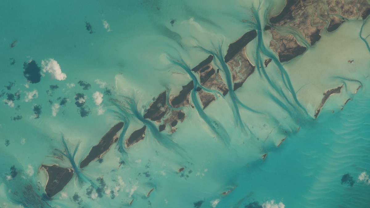
10. Bahamas’ Aqua Cays

Small cays in the Bahamas display vivid aqua waters and tidal channels. Extending from Great Exuma Island, this picturesque view showcases one of Earth’s most recognizable landmarks.
Read more
Sponsored Links by Taboola

Top Headlines

‘They'll Make Assam Part Of East Pakistan': PM Modi’s Explosive Charge Against Congress In Guwahati
India Squad For IND-NZ T20Is: Ishan Kishan, Rinku Singh Return
Bangladesh Bids Farewell To Sharif Osman Hadi, Historic Turnout Reported Amid Tight Security
PM Modi’s Helicopter Returns To Kolkata After Dense Fog Disrupts Landing In Bengal's Taherpur

Videos

Breaking News: Delhi Turns Into Gas Chamber as Dense Fog and AQI Above 400 Choke NCR
Breaking News: Telangana Sarpanch Dresses as Bear to Chase Away Monkeys, Viral Video Sparks Buzz
Weather Alert: Severe Cold, Very Dense Fog and Hazardous Pollution Disrupt Life in Delhi-NCR
Breaking Update: Dense Fog and Hazardous Pollution Paralyse Delhi-NCR, Flights Cancelled
Weather Alert: Dense Fog and Severe Air Pollution Grip Delhi-NCR, Visibility Drops Sharply

Photo Gallery

25°C
New Delhi
Rain: 100mm
Humidity: 97%
Wind: WNW 47km/h
See Today's Weather
powered by
Accu Weather
Embed widget