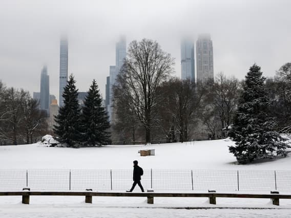
Most of the United States woke up to snow, freezing rain, and frigid temperatures as an Arctic blast swept across the country. The weather has finally ended the two-year-long snow drought in New York and put a large portion of the West into a deep freeze, according to Reuters.
According to the National Weather Service, wind chills were projected to drive temperatures down to -30°F (-34°C) across the Rocky Mountains, Great Plains, and Midwest and were likely to reach the mid-Mississippi Valley in the morning.
Meanwhile, the New York City, which has not witnessed more than 2.5 cm of snow in almost two years, woke up to a winter wonderland. Central Park in Manhattan was covered in 1.4 inches of snow by Tuesday morning, finally ending a two-year "winter drought" as the city only received a light dusting of snow till now.
"The streak has ended!" the National Weather Service's New York office posted on Facebook.
Buffalo, New York, was blanketed with 30 to 91 cm of snow overnight, adding to the 3 feet that had already fallen over the weekend. A "lake effect" snow warning was issued by the weather service on Tuesday for a significant portion of western New York, and it is expected to persist until Thursday evening. The weather service explained that the substantial snowfall experienced in western New York during winter is a typical occurrence. This phenomenon occurs as the unfrozen waters of the Great Lakes interact with frigid air in the upper atmosphere, leading to the formation of clouds that swiftly generate snow.
Washington, D.C., received a picturesque coating of 10 to 13 cm of snow, turning the city white overnight. Meanwhile, Baltimore and Philadelphia saw a lighter snowfall of 2 to 3 inches (5 to 8 cm). The weather service anticipated an additional 5 to 10 cm throughout New England, extending into New York state. A brief reprieve from the frigid weather was expected midweek.
On Tuesday morning, the lowest temperature in the country was -36°F (-38°C) in the small Colorado town of Briggsdale, which has a population of about 134. Greeley, about 50 km south of Briggsdale, recorded a temperature about 13 degrees warmer than its northern neighbor.
At least five people have died across the US, since the weekend, including two from hypothermia in recent days in Oregon, the Reuters reported.
The UK Chill
The frigid wind of the Arctic has also affected the UK, as Tuesday might just be the coldest night in January in the UK since 2010, as reported by the BBC. Temperatures are likely to drop below minus 15°C in parts of Scotland. Harsh conditions and substantial snowfall have prompted the closure of schools in Scotland and northern England, causing disruptions to travel.
Yellow warnings for ice and snow are currently in effect across all four UK nations, with the possibility of stormy weather looming for the upcoming weekend. The Met Office forecasts that by the conclusion of Friday, areas of high ground in northwest Scotland may accumulate more than 40 cm of snow as wintry conditions persist. Northern parts of the UK are anticipated to continue experiencing a mix of snow, sleet, and rain, with intermittent periods of sunshine.
Earlier on Tuesday, the Met Office posted on social media: "Tonight could be the coldest January night for 14 years, with temperatures possibly falling as low as -15°C in snow-covered parts of Scotland."
The coldest temperature recorded this winter was -12.5°C in Altnaharra during early December. Notably, in January 2010, the same Scottish Highlands hamlet experienced an even more frigid temperature of -22.3°C.
Scotland is expected to see the worst of the weather, with up to 10 cm of snowfall.
This week, the UK Health Security Agency issued an amber cold weather warning for England, signifying an anticipated increase in pressure on the National Health Service (NHS) and a higher risk for elderly people.
This week, frigid Arctic winds sweeping in have caused temperatures to drop by 5 to 6 degrees Celsius below the average temperature for this time of year.
