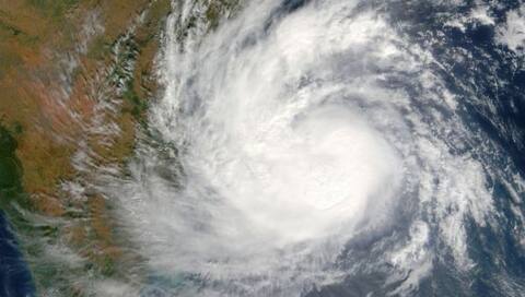
IMD issues cyclone alert for Odisha, Andhra Pradesh
PTI | 20 Sep 2018 04:54 PM (IST)
The IMD has sounded a cyclone alert for south Odisha and north Andhra Pradesh with a low pressure over the Bay of Bengal intensifying into a deep depression, triggering heavy rainfall in several districts on Thursday.

Photo for representational purpose only. AFP
NEW DELHI: The IMD has sounded a cyclone alert for south Odisha and north Andhra Pradesh with a low pressure over the Bay of Bengal intensifying into a deep depression, triggering heavy rainfall in several districts on Thursday. The depression over west-central Bay of Bengal and adjoining areas has moved westward and intensified into a deep depression, it lay centred at about 300 km east-southeast of Gopalpur in Odisha, IMD said in a bulletin. "It (the depression) is likely to intensify into a cyclonic storm and then move west-northwestwards and cross south Odisha and north Andhra coasts close to Gopalpur," it said. While heavy rainfall lashed several parts of Odisha since Wednesday, rain and thundershower is likely to occur in most places in the next 48 hours and it will ease thereafter, the IMD said. The depression caused heavy rainfall in Balasore, Bhadrak, Puri, Ganjam, Khordha, Jagatsinghpur, Cuttack, Kendrapara and Jajpur districts on Thursday, a MeT official said. Under the depression's impact, heavy to very heavy rainfall is likely to occur at some places in Rayagada, Kalahandi, Koraput and Nabarangpur districts till Friday, it said. The system is also likely to trigger heavy to very heavy rainfall in districts like Balangir, Bargarh, Jharsuguda, Sambalpur, Sundargarh, Keonjhar and Mayurbhanj on Friday, the MeT centre here said. Squally winds with a speed of 55 kmph to 65 kmph is likely to prevail along Odisha coast. Subsequently, the wind speed may even increase to 80 kmph in south interior parts of the state, it said. The sea condition will be very rough over central and north Bay of Bengal and along Odisha coast, it said adding surge of tides is likely to inundate low lying areas of districts like Gajapati, Ganjam, Khurda and Puri in Odisha. In view of adverse weather conditions, the MeT office advised suspension of fishing operations and asked fishermen not to venture into the sea till Friday. Meanwhile, danger signal no-3 has been hoisted in all ports of Odisha. Special Relief Commissioner B P Sethi has already asked all concerned to remain alert, closely monitor the situation and keep the administrative machinery in full preparedness to meet any eventuality and ensure functioning of control room round-the-clock.